Tuesday, 31 December 2013

Day 4: Riomaggiore – Monterosso – Milan - Germany


In the next day, by the time we had our breakfast it was already 10 am. We checked out in the morning and afterward headed to a nearby cafeteria to have our breakfast. Since we had no plans for today other than catching our flight from Milan at 8.35 pm there was no hurry for anything. The waitress was a very beautiful girl. Definitely very young, and her English was just “adjustable”. But how does that matter, she was doing her job relatively good and moreover I immediately forgot what her name was when she told me. She was so beautiful that there was no time to listen to her name! Afterwards we just sat on the piazza enjoying the sun and chatting. When compared to the last days the weather was perfect. Suddenly we had idea. We decided to take the boat back to Monterosso, enjoy the weather and water at the beach and take the train back to Milan in the afternoon.
That was really a good decision.  Because the view from sea towards the villages was beautiful and it looked like a postcard. As one can expect it is quite different from the impression one gets from the land. With the village of Riomaggiore and Manrola almost at the sea level and the village of Corniglia high up in the cliff, the 5 villages had its own charm and definitely justified its status as one of the most beautiful coastal villages in Italy. I was really glad on our decision to take the boat back to Monterosso.  Once we were there we purchased our tickets back to Milan and then headed to the beach. We spend more than an hour in the water. The water was a bit cold, but with the sun shining it became quite comfortable once we came out of the water. It was a perfect ending to our wonderful trek.

Our train from Montrerosso to Milan was at 3 pm. It was quite a boring journey. We lost our seats after about half an hour to other “intelligent” passengers who reserved in advance. For the rest of the journey we sat on the corridor of the compartment. We were not alone, since it was a Sunday, the train was full and a lot of people were sitting on the corridor. I didn’t care! The flight from Milan was at 8. 35 pm. After an hour we landed at Zurich airport. I said good bye to Bru for one last time. I don’t know when we will be travelling together again.  I catched the connecting flight from Zurich to Germany and by the time I reached home it was already midnight. It was a good trip, my last one, to my favourite country in Europe!

Day 3: Prevo – Corniglia – Manarola - Riomaggiore


Next day we started in the morning after breakfast at around 10 am. We have a long day ahead of us. Our plan was to hike to the village of Riomaggiore via Corniglia and Manarola. The easy walkway along the “Blue path” is completely blocked as at most of the places the pathway doesn’t exist anymore. So we have to take the “high path”.  The “high path” climb started from Corniglia. It did become really steep at some points especially the initial climb from Corniglia. Most of the time it was steps, and I really hate steps, no matter if I am climbing up or down.  After the initial climb the track became more or less levelled and the path goes through the mountain top. Though the mountain top is at an altitude of around 700 m our path was much less than that at around 350 m. Still we climbed from around 75 m altitude to reach those levels and most of them through steps carrying our heavy luggage! The weather was not so friendly, drizzling initially and then cloudy later on. Once we left the woods the landscape opened up to vineyards. The view was quite interesting with Cornilia on one side and Manarola on the other with the view of the never ending sea ahead of us and vineyards on the background! All standing on the edge of the cliff from a height of around 300 m above sea level! We took the path to Manarola via the village of Volastra. I have to admit it was a long walk.
Once we reached Volastra the path change into cobbled narrow streets which lead to a series of steps. We thought we will first have a look of Manarola before proceeding towards Riomaggiore. For that we have to walk back to Volastra from Manarola to take the high path. The only problem with that plan, as we realised later on, was that we had to climb down atleast 500 steps to reach the village of Manarola. Or to take the route back to Volastra to take the high path we had to climb up all those steps!!!  Once we started climbing down I immediately gave up the idea of climbing back those steps with our heavy luggage. After a long walk through those very very boring and stressful steps we reached the village of Manarola. It was one of the smallest villages in Cinque Terre.
While climbing down the steps the view of the village was again beautiful – small village surrounded on one side by the vineyards and the sea on the other side. There were lots and lots of tourists there. Due to rough seas there was no boat service at the jetty. We sat at a place overlooking the street leading towards the sea and had our packed lunch there. Just relaxing and enjoying the sun. We decided to cancel the plans to trek to Riomaggiore. The very thought of climbing those damn steps where not at all motivating. We decided to take the train instead. Since the boat service was cancelled the ‘piccollo’ train station was heavily crowded. Also the completely crowded trains travelling in the other direction from Riomaggiore towards Manarola became completely empty once it stopped at Manarole. This is definitely a popular tourist spot.  We took the 4 ‘o’ clock train to Riomaggiore. I think it just took 5 minutes to reach Riomaggiore.

We found our backpackers hotel in one of the main streets of the little village of Riomaggiore. It looked more like a room for romantic couples with lot of pink colour and fake decorations all over the place! After leaving our backpack and taking a shower we headed towards the seaside restaurant. We started with a beer, watching the sunset. The wind was a bit cold, still the view was good. We had our dinner – risotto de mare, and a grappa. When in Rome, be a Roman, right? We spend some time at the rocks taking some snaps and enjoying the atmosphere. After leaving our cameras back in the room we went out again. We didn’t had any plans, so we decided to try some cocktails in the nearby pub. I planned to stop after a couple of cocktails. But it didn’t exactly go that way. Some guy started chatting with us. Either he is stupid or very rich or both he started buying us cocktails, for the sake of company (he was also drinking), and we both ended up drinking one cocktail after the other. As usual Bru was in “really good spirits”. I had a Caipirihnia, French connection, 2 Jagermeister and a Bamboosa!!! And Bru had much more. Finally when our good friend left both of us were completely drunk! It has been years since I was so drunk.  We had real difficulty in finding our hostel and climbing up the damn steps towards our room in the 3rd floor. Since we couldn’t manage to lock the doors properly we placed a table infront of it!!! After a while I heard a loud sound. Bru was no longer in the bed. I saw a head popping up from the floor. It was Bru, blabbering some nonsense. That was the last thing I remembered!!!

Day 2: Prevo – Corniglia - Prevo


The next day we had our breakfast at leisurely pace. The weather didn’t look good. It was raining a bit at night and in the morning it war more cloudy than sunny. Still the views from the balcony of the homestay towards the village of Corniglia was breathtaking.  After the breakfast we decided to climb up towards the church of St. Bernadino. We had the whole day infront of us. Our plan was to hike around in the national park and visit Corniglia at some point in the day. We didn’t know the exact hike route towards St. Bernadino. But the church was visible from a distance and there were signboards pointing the direction. The only problem was that due to the landslides some of the marked routes were blocked. We still decided to go up. We reached the church without much problems and from the village surrounding the church we had a good view of Corniglia and the surroundings and also a hazy view of the village of Manarola at a distance.
From there we decided to hike towards Corniglia. As some of the routes were blocked, the hike became more and more tricky as we proceeded. There were tracks partly covered by landslides, tracks which were blocked where we ignored the warning sign boards and finally we landed up in a tarred road. The road was still going up. When we asked one of the road workers for directions towards Corniglia he was surprised and pointed towards the opposite direction!! We decided to proceed further and finally we followed a signboard that pointed towards the village.  We had the direct view of the village as we trekked down. But after a while the marked path narrowed, became bushier and reduced to a small track. We were not even sure whether it was a proper track as the thorny bushes were making our trek difficult. After a while we completely lost track of what ever track we were following and there were no more tracks ahead. We really doubted that whatever tracks we were following in the last hours are probably the tracks of a wild pig. The thorny bushes were so dense that we were scratched all over our body and blood was coming out at many places. Funny thing was that we still had the direct view of the village of Corniglia from a distance. It was too late to turn back as the track we came was no longer visible. We decided to proceed ahead getting further scratched by the thorns. Finally we landed up in olive plantations.

Suddenly I came across a snake lying on the ground. Before I could warn Bru and show him the snake the startled snake ran away. Not sure what kind of snake it was. But if I could remember correctly it was having stripes of black and yellow.  So quite adventurous experience so far in such an unlikely place. After a few meters of walking through the plantations and climbing down the stone walls we reached a road. Finally we reached a place where we had a clear idea of how to reach the village of Corniglia. We sat on the road for some time, eating some fruits and inspecting our wounds. And then we slowly moved towards the village. Like the other villages the fishing village of Corniglia was also very charming. Narrow walking streets and shops, for the tourists of course, and at the end of the street the endless view of the sea.  From there we could see our next destination – the village of Manarola.
We had our lunch there, had some beer, which we definitely earned after our hard day in the bush, and relaxed for a while. We also bought some postcards to send back. Then we started walking towards our homestay at around 1.30 pm from there. The route was easy as it was clearly marked. And walking along the edges of the mountain with the sea on one side and beautiful landscape on the other side was a wonderful experience. When we were back in our place it was around 4 pm. Both of us were exhausted. We cooked some spaghetti and opened our second wine bottle and relaxed watching the sunset, the starts and the illumination at the village of Corniglia from a distance.

Day 1: Germany – Milan – Monterosso – Vernassa - Prevo


I met Bru at the Zurich airport and then we flew together to Milan. It was nice to see Bru again. We understand each other pretty well and had been on trips together before. Our flight reached Milan at around 10.30 am. My plan was to take the train from Milan Central to Moterosso al Mare at around 12 noon. By the time we got out luggage it was around 11:30 am. And the train from Milan Malpensa airport to Milan central took us more than 45 mins. So we had to take the next train around 1.
By the time we reached our starting point – the first of the 5 villages  - Monterosso it was around 4 pm. There are two tracks to choose from to visit the villages, the first one and the easiest is called the ‘Blue Path’ which runs at almost the same height above sea level as the villages. This is also the most popular route and one can find a large amount of tourists on this route on a sunny day. The second one is called the high path which runs high up the mountains. That means one has to climb up and climb down as we move from one village to village. It is also a bit strenuous and time consuming and one needs a certain level of fitness to try this route.
At the time of our hike some portions of the blue path was closed due to landslides the previous year. Some of the tracks were partially opened and some others were completely closed till next year. From the Cinque Terre National Park website I downloaded a map of the hike routes and information about the current state of the tracks. The five villages on our hike route were Monterosso, Vernassa, Corniglia, Manarola and Riomaggiore. And our stop over on the first day was a homestay midway between Vernassa and Corniglia on the blue path.

At Monterosso we stopped by at a restaurant to pick up some food and water. I also wanted to get some information about the status of the hike route. The owner of the restaurant told us that it will take about 1.5 -2 hours to reach Vernassa and an another half hour to reach the homestay. But he is not sure whether the hike route from Vernassa is open or not. Since its already a little bit late to start the hike he recommended us to take the train to Vernassa. “Take the next train at 4:25 pm and you will be there in Vernassa in 5 mins. From there you can easily hike to the homestay. Since it’s a sunny day the hike route may be open today”. Not an optimum beginning to our hike and definitely not something that I would have liked to hear. On one hand if he was right, it was already a bit late to start and if we didn’t find the hike route, it can get a bit risky as we will not be able to find our homestay in the darkness.
We thought for a while and then decided to fuck the risk!!! No risk, no fun, right? We came here to hike, so let’s take the chance. So Bru and I decided to try the luck. With a backpack of around 12 kgs, the hike was not exactly easy. Especially to climb up the stairs from Monterosso. We had to stop in between to catch the breath. I began to wonder if it would have been wiser to do the hike from Riomaggiore to Monterosso. In spite of the difficulties, the landscape was absolutely beautiful. It was motivating enough to keep us going. It took almost an hour before we started seeing Vernassa from a distance. Vernassa lies about 3.3 km from Monterosso.  About 10 minutes from Vernassa we came to a clearing which looked like a perfect  photo spot. With the golden light of the setting sun hitting the village from a distance, it was a quite magical view. We climbed down to Vernassa and walked around the village. In between we stopped to do some shopping for the night and for breakfast the next day.

 Afterwards we continued the blue path towards Corniglia. The distance between Vernassa and Corniglia is about 3.2 km.If the path is not closed then we should be able to find the homestay halfway between Vernassa and Corniglia. From almost sea level at Vernassa we again had to climb up to proceed to Corniglia. But the walk through the woodlands with a view of the sea on one side was never boring. After about 30-45 mins of hiking we reached our homestay called “the heart of Cinque Terre” in the small hamlet of Prevo. It was an absolutely beautiful location. The garden of the house was on the cliff with full view of the sea and from the balcony of the house one has a direct view of the village of Corniglia on the mountain top. Our host Peter was a nice guy. It is a pity that he has only one room to rent. We felt really lucky to have got the accommodation at this beautiful location in the national park and also directly in the blue path far away from all the noises and disturbance that comes along with such touristic places. It was beyond doubt the best place to live in the whole stretch.
We were glad that we found our accommodation in time. Both of us were really tired from the travelling and hiking the whole day. We sat on the garden overlooking the sea, enjoying the sunset, ate our dinner and finished our first wine bottle of the hike! Life couldn’t get any better than this.  We just chatted old stories long after we finished our dinner and also long after we finished our only bottle of wine. I always enjoyed travelling with Bru. Kind of freak like me, but honest, sincere  and more over we both have the passion for the same continent – Africa!

Cinque Terre Hike

Italy is my favourite country in Europe. I usually end up travelling in Italy atleast once in a year. Though I live in Germany, I feel more comfortable and pleasant to travel in Italy than in Germany. Especially when compared to the weather, Germany is not at all an attractive option. More over I like the Italian culture, and of course the Italian girls.
The moment I saw the picture of Cinque Terre in some website, I marked it in my mind to go there some day. But the fact that it’s a bit far away from any of the biggest international airports made me postpone the trip more often. The hike was never in my mind as I didn’t know that one can hike from one fishing village to the other. I came to know about it only when I tried to figure out the nearest airport I could fly to from where I live. Once it was clear that hiking between the villages is the best way to see the region I was excited. I am an outdoor person, so the possibility of hiking was like God send.
I didn’t want to do the hike alone. I checked with some of my Italian friends – too busy, other commitments etc. Then I checked with Bru. I was half optimistic as he is busy most of the time. To my luck, he was very keen to do it. We decided to fly to Milan and take the train to the first village. Since Milan is a big airport, we had the chance to find more cheap flight options. In May I had a long weekend from Thursday till Sunday due to some kind of religious holidays. So we decided to go for the hike on that weekend. 4 days means we had the luxury of doing the hike at a leisure pace.

Friday, 23 August 2013

Day 14: Leh


Namgyal Peak
Am left to Nubra valley today morning. She is staying there for 3 days. After breakfast I packed the handicrafts that I bought yesterday in a cardboard box that I got from the homestay family. I took it to the post office in the town to send it as parcel to my home. As with typical government offices in India, one needs a lot of patience if he wants to get something done here. It took almost 1.5 hrs for me have the lady in the counter look at my need. She said I have to open the box as she needs to recheck what is inside. So I cut open the neatly packed box and showed her the contents. She said I can’t send it as the article contains metals!!! I didn’t understand what she meant so I asked again what the problem is. She said since it is send by flight it is not allowed to send any articles with metal!!! I was surprised! It can’t be true that I can’t send any metal item by parcel from Leh. I came out of the office and asked the police man on street patrol whether there is any other possibility. He asked me to check the head post office about 2 kms further ahead. He also mentioned that may be I could ask the post office here whether its possible to send it from the head post office. So I went back and asked the lady in the counter the same. She said she doesn’t know!!!! That’s what one calls an “efficient and well informed government office”. Hopeless! I think I should tell myself “Welcome to India”. I think this is just a teaser for what to come in the coming days, months and years. Will I survive? I don’t know, but I have to, somehow!!

Day 13: Leh


Shanti Stupa
My flight back home is in two days time. I decided not to do anything and relax the two days here. After breakfast I wrote all the post cards that I wanted to send today. I didn’t have the mailing address of some of them, but the rest I wanted to post today.

I went to the town in the morning. Walked around the Tibetan refugee shops where they sold beautiful handicrafts. If I had the money I would have bought all of them. In the end I bought a prayer wheel and a statue of sleeping Buddha. I wanted to send it as parcel to home as my luggage is already a little bit overweight.
I went out in the afternoon again to have a small lunch in the town. I didn’t spend much time there, came back and had a shower. In the evening I did some timelapsing of the Santi Stupa. Am and I went out for dinner at night. I invited her so as to thank her for massaging my shoulders during the trek.

Day 12: Shang Sumdo - > Martselang -> Leh


Martselang
The rainy weather continued to today. It was raining when we woke up. The whole tent was wet and the wet conditions outside made the packing difficult. We had out last breakfast in the kitchen tent. The cook has prepared a special cake, which was very nice of them. Am didn’t want to walk in the rain with her knee problems and the other other british girls were also not keep to walk either. I didn’t mind walking as I thought the rains are part of the trekking experience. More over its walking and enjoying the landscape even if it’s raining. So Stan decided to call the agency to have the pickup arranged at Shang Sumdo for the 3 of them. The plan was that Stan and I will walk to Martselang village where our official pick up was supposed to be and the girls will start from the Shang Sumdo at a later time. And we all will meet at Martselang. But the plan didn’t work out as Stan couldn’t get any telephone lines to Leh. In the end we all decided to walk to Martselang. When we started there was no rain, but later on it started to rain again. It was not so much of fun as we were walking along the road and the landscape didn’t change much.
Once we reached Martselang our jeep was already there. Still we waited there for almost an hour for the pony guys with the luggage to join us. We could have left early and let the luggage come later on. But we wanted to say good bye to the guys properly. Our guide Stan, the cook, the pony man, the helper Gan was all very nice to us during the last one week. It was only apt that we thank them properly for all the services.
Markha Valley Trek

A visit to the monasteries on the way to Leh was included in the trek program. Since Am and I had already visited them we decided to go directly to Leh. The British girls went with Stan to visit the monasteries and Am and I to our homestay in Leh.
Once in our homestay, I decided not to go anywhere and have a shower and take rest. Am gone out to check the mail. The last 8 days had been incredible. A test of endurance and fitness!  In the end I think we walked more than 100 kms, climbed two high passes (4950 and 5300 m), walked through heat, cold and rains. I have never done anything like this before. But it was times well spend.

Day 11: Nimaling -> Shang Sumdo via Kongmaru La


Kongmaru La
 
It rained a lot yesterday evening and night. In any guide book it says that there can even be snow in the plateau in summer. Luckily it didn’t snow yesterday. But still it was very very cold. The rain continued into the night. So when we started our trek we all had to wear our rain gear.
The first phase of the trek was to climb to the Kongmaru La at 5300 m. The climb was steeper than what we had ever faced before. 4900, 5100, 5200….I was struggling to climb and also to breath normally at the same time. The final climb to 5300 m was very very steep. So steep and exhausting that I think I was moving at snail’s pace covering just few cms in each step. Once we were at the top of the pass it was a thrilling experience. In all these passes here there are Buddhist prayer flags tied at the top. So the moment you started seeing them when you climb, the thought that you are close to the goal is very motivating.

At the top it was very windy and cold. So we didn’t stay there longer. The first 300 m descend was very steep. It puts a lot of load on ones knees. We descended almost 1000 m in one stretch. Afterwards it was pretty challenging walk through the rocky canyon. We had to cross the Shang river at many points as the paths were not clear. Sometimes we had to climb up and come down again as there were no trekking routes available. It was pretty stressful walk. The rains in between made our trek more difficult as the wet rocks were very slippery. We had our first tea stop at a tea tent at around 1.30 pm. We still have to walk around another 2 hrs at least to reach our camp at the Shang Sumdo village.
The walk in the afternoon was not so stressful as most of the time we were walking at the same altitude. But it was a long and tiring walk. Am was still having problems with her knee. So our helper Ganga and I slowed down to keep her company. Stan went ahead with the two British girls. The landscape was very beautiful, just like our trek in the last days. But the slow and long walk made the journey very tiring. It also started raining again in between. Finally we reached the camp at around 4.30 pm. So altogether we were trekking for around 8 hours today! Now all I could think of is to hit my mattress in my tent!


Day 10: Tahungste -> Nimaling


Kang Yatze
I slept really badly yesterday night. I tried some star trail timelapse yesterday night. Till 12 I was rolling around in my sleeping bag. Finally when I managed to catch some sleep I was awaken by the cry of a donkey. The donkey was tied near to our tent. Somehow the stupid animal found it funny to give a loud cry at every hour!! That meant I was woken up every hour at night!

We started early like before at 8 am. My GPS showed an altitude of 4310 at our campsite. And the next camp is at 4700 m. Our guide Stan said it will take only 4 hrs to reach there. It was a gradual climb throughout. Probably because of the lack of sleep I was more tired than before. The thin air meant my climbing rate was very low when compared to others. I was making really small steps so as to have a tolerable breathing rate. Still whenever we stopped I was breathing at a very high frequency. It was not at all an easy climb for me.
All through the climb we had the beautiful view of Kang Yatze (at 6400 m), which was snow-capped, at our tight. After about 2 hrs we stopped at a pond made from spring water. It was quite refreshing to wash the face with the cold water from the natural spring. We spend almost half an hour there relaxing, and enjoying the view of the mighty Kang Yatze in the background. There is one more pond, about 10 m from where we stayed. I think the water from that pond flowed into the pond where we stayed before trickling down through the mountain valley.

Afterwards we proceeded to our final trek to the plateau of Nimaling where our camp is. Slowly, breathing heavily and exhausted I somehow managed to reach our campsite. On the way we could see our trek route for tomorrow high up in the mountains. We have to climb to the Kongmarula at approximately 5300 m tomorrow. That’s going to be a tough one. I have to make sure that I stay fit and catch some good sleep today.
We reached the campsite at around 12.15 noon. Our campsite at Nimaling is a very beautiful plateau with no shades. Quite windy and cold when the sun is behind the clouds. The Nimaling Chu flows with full strength on one side of the plateau. My GPS showed an altitude of 4850 m. I was breathing more frequently even while moving around. Not a comfortable feeling! I tried to catch some sleep in the tent after lunch, but with no success. I walked around the plateau and went to the tea tent, where one can have beer also in addition to the tea. I met the 2 Austrian and 1 German lady there, enjoying their beer. I met them in our first camp at Jingchan. Since they also had the same schedule as us we met each other irregularly during the last days of the trek. I ordered a tea and chatted with them for some time. For me it was an opportunity to rehearse my German so as not to forget it too soon.

Tomorrow is going to be a long and exhausting day. I hope I will be able to get good sleep tonight. After climbing the pass we have to reach the village of Shang Sumdo tomorrow. It would take at least 8 hours of trek I guess. The toughest day of the whole trek probably!!


Day 9: Markha -> Tahungste


We started the trek early today. Stan made sure that we left at 8 am. It was a good idea as we will be reaching the camp earlier than before, giving us enough time to rest.
We climbed the cliff at Markha where the monastery is situated. Once above we had the beautiful view of the valley on one side and the village on the other side. After about 40 min we had our river crossing. I made sure that I had the sandals this time. Though that made walking through the rocky river bed easier and the water was only knee deep, the water was colder than yesterday. At midway through the crossing my feet started to paining because of the cold temperatures Still it was an interesting experience.

Most of the time we walked along the Markha river. We passed the Umlang Gompa, which sits on a cliff overlooking the valley, on the way. Stan told us that there were only a couple of monks living there. We passed the Umlang village shortly afterwards before proceeding to the village of Hankar. We stopped there to have our lunch break. It was close to 12 noon now and the sun was getting hotter as before.
Once we passed the Hankar village we started seeing the peaks of Kang Yatze (at 6300 m altitude) at  a distance. We took a shark left turn from the valley and leading to a steep climb. We passed the ruins of a Gompa and ended up in a beautiful village with Mani stones, stupas, mustard fields and the ruins of the Hankar Gompa. It was so beautiful that the whole landscape looked like a postcard. Proceeding further we reached the Nimaling Chu river, which also opened up the entrance to a gorge leading to our camp. Strange rock formations on both sides of the Nimaling Chu river welcomed us as we made our slow climb towards the camp which is at approximately 4200 m high. At some stretches the climb was very very steep. The heat of the day made our ascend very stressful.

We reached our camp at around 2.15 pm. The camp at Tahungste is on the banks of Nimaling Chu river which is covered by green pastures. The river was flowing at high speeds and the water was muddy and ice cold. Still there are some springs around with crystal clear water. I washed my body with the cold water from the spring. Though cold it was really refreshing experience. Now the whole day left for relaxing which is really good. Tomorrow we climb to the highest camp of the trek at approximately 4700 m.


Day 8: Skiu -> Markha


It is going to be a long day today. We have to walk the whole way along the valley to Markha. We started up late at around 9 am. In hindsight we should have started early as it gets really hot later in the day. The valley is very beautiful with green patches along the Markha river surrounded by barren dry mountains. The contrast was terrific. It got really hot in the afternoon and the going got tougher. Even small slopes became difficult. We stopped at the village of Sara (a couple of houses) to have our lunch. We left at around 1 pm. Our guide Stan warned us that we have tor each the river crossing near to Markha at around 3-4 pm at the latest as afterwards it may be difficult to cross due to the possibility of high water levels. The water in the river comes from the glaciers. As the day gets hotter the glaciers melt faster leading to an increase in the amount of water flowing. There we had to hurry up to cross the river in time.
It was a difficult trek in the hot sun. Most of the places didn’t have any shade, exposing us to the hot midday sun. My video camera stopped working after some time. I guess it was the heat. Finally we reached the river crossing at around 3.30 pm. Luckily the river water level was only knee deep. I forgot to take my sandals with me. I sent it along with my main luggage with the ponies. That made crossing the rocky river bed in bare foot quite uncomfortable. In addition the water was close to freezing. But everything went on well. About 1 km after the river crossing we reached the village of Markha.

There is an old monastery on the top of the cliff overlooking our campsite. The Markha river flowed in full strength on the side of the campsite. I was completely exhausted from the long day of trek. Its already 4 pm and we walked more than 20 km today, most of the time in the hot sun. My shoulder was also paining a lot from carrying the backpack. Am gave me a shoulder massage again, though she herself was completely exhausted. We finished our dinner at 8.30 pm and I immediately went to bed. I also took a pain killer as my shoulder was not looking good.


Day 7: Ganda La Basecamp -> Skiu


Kanda La
We had to climb the Kanda La pass today which is at approximately 4980 m high. We started from our upper base camp at around 8.30 am. The climb was steep, so the going was slow. On the way we saw marmots. Though the climb was hard the scenery was breathtaking. We were climbing through the Stok range of mountains. It took almost 2 hrs to climb from 4545 m to 4980 m where the highest point of the pass is. After taking rest and taking photos I climbed to the ridge of the pass to take some ariel shots of the pass. The GPS showed 5026 m at the top of the ridge. It was a beautiful sight with the Stok range of mountains on one side and the Zanskar range on the other side of the pass.
Afterwards we descended towards the village of Shingo which is at 4150 m. Like all the villages in our route Shingo also has only a couple of houses. The village sits in a a gorge and there is a arrest camp at the entrance. We had our lunch there and around 1.30 pm we started walking towards Skiu where our camp for tonight is pitched. The walk towards Skiu from Shingo goes through a beautifully coloured rock laded gorge. A small stream flows along the gorge towards Skiu. Am was slower than the rest of us as her knee was not feeling well. So our guide walked in the front with other girls and I stopped in between so that Am can catch up with us without getting lost The walk through the gorge was fantastic. It took more than 3 hrs for us to reach Skiu.

There is a monastery at Skiu at the entrance of the village. Other than that there are probably about 20 houses in the village. Since our pony team reached the village late we didn’t get any camping place directly at the village. Our camp was instead pitched at the beginning of the Markha valley, on the banks of the Markha river.  I actually loved that place as it was far away from the crowd, peaceful and quiet with a fantastic view of the Skiu monastery at a distance. All of us were really tired from the long trek. I unpacked my bag and headed to the river to wash my body. The water was freezing cold, still it was so refreshing that I am glad that I did that.
At dinner Stan organised some local beer, called Stang, made from barley. We talked about it before, I never thought that he will take time to organise it. I just had a cup of it. It was a sweet beer, more like the Cider. I don’t know how strong it is. As even after a mug of it I felt alright.


Day 6: Jingchen -> Ganda La Basecamp


Yurutse
We started at 8.30 in the morning after breakfast. Initially we trekked along the Jingchen gorge crossing the Jingchen river many times and slowly climbing altitude. The route took us through the Hemis national park. The river crossing was not at all difficult. It was a long day of trek with the temperature rising as the day progressed. At around noon we reached the village of Rumbak which is at 3800 m.  The route bifurcates here, one going to towards the Stok La and the Stok Kangri mountain and the second towards the Ganda La basecamp. Here one or two houses constitute a village. There is a tea tent run by the Ladakhi women where we had our tea and a long break.
Afterwards we proceeded towards the village of Yurutse which is at 4120 m altitude. The hot climate, the thin air and the weight of my backpack was making my climb difficult. Am and I were moving at snails pace where as the girls and the guide were usually moving pretty fast at the front. There is also a homestay at Yurutse. Just one building and it is the Yurutse village! It is a beautiful location. The homestay sits on the side of a green lush valley surrounded by barren mountains.

We were so tired that we decided to take a break and take our lunch there. We still have to climb 400 m today. After an hour break we stared our climb again. It was a slow climb, but the landscape was really beautiful with the mountains half blue in colour. We could see the Stok Kangri mountains at a distance. After about a tiring 200 m climb we reached a  camp with a small tented restaurant. This is the lower Ganda La camp. We were so tired that I thought we will be camping here. But our ponyman and the cook had already climbed further and pitched the tent at the upper Ganda La camp!
We took a half hour break  and climbed again. Slowly, but steady, we reached our final destination – upper Ganda La base camp at 4545 m – at around 4 pm. The tiredness made all of us to lay down on the mattresses and sleep for a while. Later on we had our tea with biscuits. I tried some timelapse photography while Am did her meditation. I had some slight headache, probably from the high altitudes. My shoulder was paining a lot. After sunset the temperature dropped drastically. I guess it should have been between 5  - 10 degrees. After dinner we quickly went back to the warmth of our sleeping bags in the tent. Am gave me a shoulder massage using the pain balm that I had with me. It was very helpful and it was really nice of her to do so. Tomorrow is going to be a hard day. We have to climb the Ganda La pass which is at 4900 m. Hope my headache will be gone by then. Fingers crossed!!


Day 5: Spituk -> Jingchen


Our trek agent picked us up from the homestay at around 8.30 am. For the trek there was also two British girls joining us. The agent’s jeep took us to Spituk first, from where our trek starts. It is also the place where the cook, pony, horses etc for the trek joined us. The trek to Jingchen is supposed to be not so stressful.

In the beginning the trek went through a desolate plain which ran parallel to the Indus river. After sometime the path split into a narrow gorge where one gets an impressive view of the Indus gorge. We could see some people doing river rafting in Indus. Leaving the Indus gorge we turned left to enter the Jingchen gorge. The day was getting hotter and we took a couple of breaks in between. We walked parallel to the Jingchen river which runs through the gorge. At around 2 pm we reached our campsite at Jingchen situated at the banks of the river. The camp was crowded with trekkers and their ponies/donkeys. We had 2 tents with Am and I on one tent and the 2 girls on the other. In addition there was a kitchen tent where the cook prepared our food.
After taking our packed lunch almost all of us took a nap in the shades. All of us were very tired. We had nothing to do for the rest of the day except relaxing, which was nice. The Jingchen Nala river water comes from the glacier in Stok. So the water was very cold. But the fresh water also helped me to refresh myself. We had a wonderful dinner. I was very surprised that they managed to make such delicious dinner in that tiny tent. After dinner I tried some star photography. Our camp is at an altitutde of 3380 m. Tomorrow we have to try to reach the Ganda La base camp which is at 4545 m. That’s around 1200 m climb in thin air. It is going to be a lot stressful day.


Tuesday, 30 July 2013

Day 4 : Pangong Tso -> Leh


The day started early. I woke up at around 5 am to take photos of sunrise. It was not a good idea as the sun is behind the mountains most of the time. By the time it becomes visible it is no longer possible to recognise suns contour. But still it was a beautiful scenery with the golden rays of the sun falling on to the slopes. After the breakfast we hanged around in the camp till 9.30 am. The return trip to Leh was quite tiring. As before it took us around 5 hrs to reach Leh. Am and I got down at the town, had our lunch, did last minute shopping for the trek tomorrow and then returned to our homestay. I didn’t go out afterwards. Instead took the time to do the packing and relaxing. Mo was there for dinner as well. We chatted for a while before returning to our room.

Day 3: Leh -> Pangong Tso Lake


Pangong Tso
We rented a car to go to the Pangong Tso lake today. The agent picked us (Am, Je and me) from the homestay at 9 am in the morning. The lake is in the east of Leh, close to the Tibetan border. The lake is about 140 km long and about ¼ th of it is in the Indian side. The highlight of the lake is the turquoise colour arising from the rich mineral content. The lake has no outlet, that ie, the mineral rich water that flows into the lake from the mountains stays there. Also, due to the high mineral content the lake does not support any aquatic life.
Along with us there was a british couple who was sharing the taxi. The driver was the same person who took us to the monasteries yesterday. We started from Leh around 9.30 am and it took almost 5 hrs to reach there. The route took us through some of the most amazing landscapes that I have ever seen. We passed through the Chang La pas which is at a height of 5360 m. The pass was partially covered with snow and the wind was colder at the pass as expected. In the winter the pass is prone to avalanches. Since it is close to the Chinese border there is also a strong military presence here. We came across many army check posts and vehicles all along the way. The lake was closed to tourists till 1994. Since it was opened, the ill effects of tourism – viz. the wastes from tourists, disturbance to wild life etc. – also started. In one way you do not like to have any tourists there and on the other hand it is such a mesmerising sight that you don’t want to miss it!

We reached the lake in the afternoon and had our dinner in one of the shacks on the banks of the lake. The beauty of the lake on the barren landscape of Ladakh cannot be described in words. If there is a heaven on earth then it should be here. We had our accommodation in one of the tented camps on the side of the lake. It is a bit expensive for my budget, but it was worth every penny. I am glad that I booked it. One thing that really irritated me are the people driving their cars and bikes to the edge of the lake to take photos. Idiots, trying to look macho!!!! Other than disturbing the delicate ecological balance of the nature these people do not do any favour to this beautiful environment. I couldn’t understand why anyone would want to do that when they have the chance to enjoy this beautiful environment from a distance and help to maintain this beauty for the future generations!
After taking a short break and dumping our bags in the tent we went to explore the surroundings. Everyone on their own, and me with my ever trusted camera. I also tried to do some timelapsing, which didn’t work out during my last trip to Africa. It was so peaceful and beautiful that I didn’t want it to end.

We had the dinner in one of the tents in the evening. Then we chatted for quite some time before returning to the tent. The wind was pretty chilly. I decided to do some night time photography. Aim was to try some star trails. It didn’t work out as I wanted it to be. But I did end up taking some nice shots of milky way and a shooting star! Not bad, for an amateur photographer.

Day 2: Leh


Shey
 We planned to visit the monasteries on the outskirts of Leh today. The ones we wanted to visit were Hemis, Tikse, Shey and Stok. In addition to Am and me an American girl named Je also joined us. We rented a car together and left the homestay at 9.30 in the morning. First we visited Hemis monastery. The road to Hemis went through the amazing landscape of Ladakh. Blue skies and multi coloured barren mountains surrounded the road to Hemis. At some point the road ran parallel to the Indus river. It is beyond words to describe the beauty of the landscape.
 
Hemis is the biggest and the richest monastery in Ladakh and it took around an hour to reach there. It is the first Buddhist monastery that I ever visited in my life. It was constructed in the 12th century. The multi-storeyed building included the main prayer hall and a huge statue, about 12 m long, of Guru Padmasambhava. There is also a museum which showed the different statues, tools and tanka from the earlier times. We spend about 2 hours there, walking around the monastery and taking photos.

Next we visited the monastery at Tikse. This was definitely the most beautiful of the 4 monasteries that we visited today.  The large gompa rested on the top of hill which can be seen from far away. It was a beautiful sight to see. The highlight of the monastery is the 15 m tall statue of Maitreya (future Buddha). It is definitely one of the most beautiful statues of Buddha that I have seen. The rest of the monastery was similar in architecture like Hemis, though on a smaller scale. From the top of the monastery one can get a good view of the surrounding landscape. After visiting the monastery we took the dinner at the restaurant attached to the monastery.

From there we went to Shey which is on the way to Leh. Shey was the capital of the old Ladakh. The Shey palace includes a Buddha temple and a stupa topped with gold. From the top of the palace one gets a good view of the surrounding area which includes many stupas spread over the landscape.

Our last stop was the palace at Stok where the royal family currently lives. The palace includes a museum where the impressive crown of the queen is exhibited among other things. Though small in size the palace is surrounded by mind blowing landscape. There is a café at the entrance of the palace which overlooks the beautiful landscape. We all had a chai there, relaxing and enjoying the peaceful atmosphere. Wish I could stay there longer.

On the way back to the homestay we got down at the town to have dinner. Once again a long and tiring day, but also wonderful and interesting!


Day 1: Leh


Shanti Stupa
The plan for today was to roam around the city Leh. The first in our itinerary was the Leh Palace. Overlooking the town of Leh, the Leh Palace was built similar to the Potala palace in Lahsa, but in a smaller scale. It is 8 stories in high, though the royal family used only the top floor for living. The rest I think is for storage and other purposes.

Am and me walked through the narrow alleys of the old town of Leh in the direction of the palace. The route was easy to find, as all you have to do is to walk in the direction of the palace. The old town seem to have frozen for decades with mud walled houses and pebble streets and the street dogs (many of them) occupying each and every corner of the alley. The climb to the entrance of the palace was not so steep. Still, I realised the high altitude effects, with breathing heavily in a few hundred meters. Just after one day in Leh, my body is definitely not acclimatised. Not surprising as the minimum number of days required, as per experts, is 3 days.

The palace is undergoing a lot of restoration works. Inside the palace is there is a photographic exhibition of the photos taken from the end of 1800’s. One could see that the region  hasn’t changed much in the last century. Other than that there is not much to see in the palace as most of the mud walled rooms were empty. But the view of the town from the top of the Palace was magnificent.

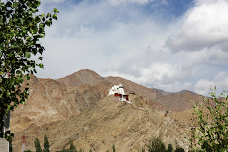
From the Leh Palace we climbed to the Namgyal peak. Slightly steeper than the climb to the palace, it was a good test to see if the body is ready for the trekking days ahead. As before, I felt tired and breathed frequently as before. I made a couple of stops in between. The peak includes the fort of Tashi Namgyal which overlooks the Leh palace and the temple of Maitreya (future Buddha). It is also the place where the king offered the bodies of the defeated Mongols to the deities. The peak offered a breath taking view of the city of Leh.

From the Namgyal peak we climbed down to the city to have our lunch. Our next plan was to go to the office of the Womens Alliance of Ladakh. According to my guide book there is a small film show about the culture of Ladakh at 3 pm every day. When we reached there we realised that the film is no longer shown there. We didn’t know about it before as the travel guide is already 8 years old. At 3 pm they had a meeting of the Womens Alliance planned. So they invited us to take part in the meeting in order to get an overall view of the work done by the group. It was quite interesting. About 20 Ladakhi women were there in the meeting. They explained about the origin of the alliance and the work done by the group. The group goes from villages to villages educating the villagers about the importance of sustaining the Ladakhi culture, being self sufficient, prevention against diseases like TB, HIV etc, efforts to ban plastics in the region etc. It was quite an impressive effort with the alliance started with 70 people and having grown to about 5000 people.

Our initial plan was to go to the Shanti Stupa in the evening and watch the sunset from there. We cancelled the plan as the day was mostly cloudy. While we were coming back from the Womens Alliance the weather became partly sunny again. So we decided to carry on with the plan to go to the Shanti Stupa. With 554 steps to climb, it was not an easy task. In fact climbing the steps in the thin air was really difficult. Once on the top I was quite glad that I decided to visit the Stupa. It had a peaceful atmosphere with the Tibetan chants through loudspeaker in the background and also offered spectacular views of Leh from above. After taking a tea from the café at the Stupa we climbed down to the town for the dinner. Afterwards we went back to the homestay to end a somewhat tiring day.


Friday, 26 July 2013

Day 25: Back Home

Back to the grey, dull and cold Germany!! Sitting in the train from the Frankfurt airport to the town I live. It was a horrible flight from Windhoek. The flight was delayed by more than 2 hours. And that too after they have preponed the starting time in the first place. By the time the plane left the runway it was around 10 pm. That is after about 7 hours since I reached the airport. Then it had a stopover at Luanda for some reason. In the end I missed my connecting train from the Frankfurt airport! What a journey! Probably a reminder to what lies ahead for me – the reality!
Sitting in the train, I am still trying to get a grip on my emotions. I had sent a sms to the Lady to see if everything went on well with her connecting flight from Johannesburg. Worrying unnecessarily I guess. Still very much confused about how everything went so wrong. Wonder whether it is wrong to like someone? I may never know what she thinks. All I know is that I like this women a lot and sincerely care about her. We have a lot in common – similar interests, similar views and more or less the same wavelength. From our time together in the last one month one thing I am sure about is that I will never be sorry for holding her hand as I genuinely felt so. I am only sorry to know that I hurt her by that. Will we ever be friends again like the way we were before or will I ever see again? Let the destiny decide that. I am happy that I met her.

Day 24: Windhoek - > Home


We had our breakfast at the hostel. Since we had to check out before 10 we packed our luggage and left it in the storage room. I had my flights only late evening and the Lady had her flights in late afternoon. Since we didn’t have anything else to do till our transport to the airport at 2.30 pm we decided to take a walk to the city and do window shopping as usual.

The Lady again seemed to be less cheerful today and chatted very less, may be a few words in an hour. As before, I was clueless, especially since she was in better spirits last nights. After roaming around some craft shops in the city we stopped at a café as the Lady was not so keen on ‘looking at the same things again and again’. I didn’t mind that actually as I thought I might come across something interesting at some corner. A few minutes earlier I came across a leather wall hanging which I thought of buying. But it was too expensive for my budget.
While sitting at the café the Lady hardly talked. She was playing with the straw of her juice all the time. It doesn’t take rocket science to see that something is not in order and I tried to ask her once and got the same old vague reply back. Clearly she was in no mood to talk and it was frustrating for me to be in a situation where I end up annoying her than helping her. I really wished that I could run away from there. After some time she said she is going back to the hostel and would like to sit down on the shade and read something. And suggested that I can go ahead with the window shopping.  But this is Windhoek and it is not safe for a tourist with a handbag to walk alone to the hostel. We had been warned before by the hostel staff and I didn’t want to take any risk on the last day. Moreover, for me the question of letting her go back alone didn’t exist at all. So I decided to walk back to the hostel with her though I was not so sure whether she liked it.

 I felt more and more that our friendship has come to an end. It started with the ellies in Swakop.  And now it has turned a full circle at Swakop. We were closer before than now. There was more trust and openness between us. In the last 4 weeks all those seemed to have vanished. There were times I felt that she is more interested in texting (whoever that lucky person is) than talking with me. Those times I felt more like a driver than a friend. There were times I felt like talking to a wall than to the dear friend I knew before. How did it come to this? I don’t know, and probably I will never know. I thought about talking to her about it sometimes.  Then decided against it as it won’t mean anything to her and most probably I will get the typical vague answers again. Now I really feel that she was a close friend only in my mind and for her I was always just a “travel buddy”. Probably it was like that all along and the I let my stupid mind run wild, as usual!
The driver from the African Tracks car rentals came to pick us up at 2.30 pm. After coming back to the hostel we hardly talked in between. I hurt to see that someone whom you considered as a close friend has just few words for you than to the driver who is a total stranger. The Lady checked in first as her flight with the South African airways leaves at 5.15 pm and mine was supposed to leave only at 8 pm. We had a late lunch at the airport restaurant in silence. I went to the security check to see her off. I decided to check in after she has left as I don’t think that I could see her leave.

The goodbye’s happened really quickly. I was quite numb, couldn’t remember what I was mumbling at that time. After checking in my luggage I sat down at one corner of the airport almost in tears. I wondered whether it is because I just lost a friend or is it more than that. I really don’t know. I don’t think I will meet her again. I am not even sure whether I will be in touch with her again like before. I would have loved to , but it didn’t seem sensible where there is a lack of trust and openness between us. I don’t want to be a friend “who is nice to have, but not absolutely necessary”. Even if she meant a lot to me! Life is full of surprises and one can only hope for the best.
I came to Africa trying to figure out my point of equilibrium of my life and I wonder now whether I will ever find one. I think the truth is that our friendship has finally run out of steam. I needed her and she never needed me. All she needed was just a travel buddy! And I am sorry, I am not that person!

Day 23: Swakopmund:-> Windhoek

We didn’t had any plans for today like yesterday. The main reason why we decided to come here rather than staying at Windhoek was to relax and be lazy. We got the spontaneous idea to go for a overland flights over Sossusvlei. I had been in Sossusvlei when I came to Namibia for the first time in 2008. It’s undoubtedly one of the most beautiful places in Namibia. The red coloured desert and the salt pans in the middle of it with skeletons of trees is a real natural wonder. I assume it will be more spectacular to see it from the air.
It was an expensive option with costs starting at a minimum of 240 euros per person for a 2.5 hours flight. But still I felt like it is a once in a life time opportunity to do so and if lucky we will get some nice snaps. Unfortunately we were too late to book the flights and since we have to get back to the bus station at 1.30 for our trip back to Windhoek our options were limited. So we decided to spend our time by window shopping as before. In a way it was good as it is stress free. Being with the Lady and to chat with her once in a while is always a good option. At the back of my mind I could still hear the clock ticking for our parting. I hate good byes, period! And with the Lady it is going to be harder even if it is going to be one sided feeling.

We took the public transport to get back to Windhoek. It is the first time in our whole trip that we are travelling on public transport. In all other occasions we had our own car or we travelled on other means of private transport. So it was a unique experience when compared to the relatively luxurious option that we used for going to Swakop. Still it was a good to travel with the ‘locals’, just getting a glimpse of their lifestyle. We reached Windhoek in good time at around 6.30 pm. We checked in again at Chameleon where we left our big luggage before heading to Swakop. We had already booked a double room for the night and it turned out to be a really good decision. For the first time in our whole trip we had a little bit of comfort and privacy.
After having a hot shower and sorting out our luggage we went to bar to order a pizza. But it was too late. So we had to settle down for a couple of beers and some chips. Not so bad! One last evening with the Lady and it went better than expected. She was in good mood and also opened up a little bit I think.

Day 22: Swakopmund


We didn’t have any specific plans for today other than just window shopping. After having a breakfast at the hostel we went for a walk in the town. The only goal was to check out the curio shops and buy some souvenirs if we find something interesting. We stopped by the beach to do some photography. I also took the time to check my emails, which I haven’t done for the last 3 weeks. I had applied to some jobs before I left and wanted to see if there are any responses to it. There had been some and I sent quick replies promising to get in touch again once I am back home in Germany.
The Lady and I continued with our window shopping latter on. I bought some paintings from one of the craft shops and then went back to the hostel at noon to have our lunch and a small break. In the afternoon we were back in the town popping in and out of shops again. As the sun started setting down we spent some time in the beach. The Lady was in a better mood today. At least she showed some interest in chatting a bit, which was nice. We went to the light house restaurant in the evening for our dinner. We were at the same place around 2.5 years before while we were both doing the volunteer project with the desert elephants. Our friendship started with the ellies in the deserts of Namibia. Now we are back here at the same place where it all started. And now I feel like our friendship has turned one complete circle. I invited her for the dinner. I felt like doing it, a parting dinner perhaps? Glad that she accepted it. Little bit of chatting and watching her talk made my evening.

When we were walking back to the hostel along the same street as before I realised how different it is now when compared to the old times. We were closer then, and now we are more like strangers, “travel buddies” as she would say. Missed the good old days!

Day 21: Harnas Rest Camp -> Windhoek -> Swakopmund

Its going to be one more long day today. First we have to drive around 300+ kms to Windhoek. We have to return our car there and then proceed to Swakopmund using local transportation which will take another 4.5 hrs.  Also, we should aim to return the car before 12 so as to avoid paying the rent for one extra day. It was a long drive, through tarred roads almost all the time. After driving through the bush for majority of the times it’s a bit boring to drive through the uneventful highways. Also, it was a bit tiring to drive through without any proper break.
We were able to give back the car at the African Tracks just after noon. In the end we drove approximately 5100 kms in 3 weeks through 3 countries - Namibia, Zimbabwe and Botswana. One hell of a ride, incredibly lucky and unlimited memories for a life time! We had to pay additional 900 N$ for the missing number plates and the scratch from the high lift jack on the side panel just above the rear tyre. Overall I guess we were lucky to be let off without any further charges, considering the adventurous drive we had the last weeks. The rental agency dropped as back to the Chameleon backpackers afterwards. It is where we stayed on our first night in Windhoek 3 weeks ago. The receptionist at the backpackers arranged for us the transport and accommodation at Swakopmund.

We left our main luggage there and left to Swakop with just a backpack necessary for the next two nights. We decided to go to Swakop instead of staying at Windhoek as it is a beautiful town on the beaches and also it is much safer place than Windhoek. We can move around freely without the need for looking over our shoulders for trouble all the time.  It was again a long trip, around 4.5 hours.  We reached Swakop around 6.30 pm. After a quick shower at the Villa Wiese, which is the same backpackers where we stayed 2 years back, the Lady and I went for a walk along the beach.
We hardly talked during the whole day. And while we were walking she seemed to be annoyed for some reason. Or at least she was not in her best spirits. I tried to keep some distance so as to avoid further trouble. In the evening we had dinner at one of the bars and went back to the hostel. One more uneventful day. Wish I could see her smiling and chatting cheerfully like before again. All those seems like past. `I no longer have a feeling that she likes my company. It feels more like she is somehow killing time before her trip back home. And it won’t necessarily matter who helps her in killing the time, either it’s me or somebody else. The best thing I could do now is not go get things worsen further. I hope I will be able to do that!

Day 20: Dqua Qare Game Farm -> Harnas Rest Camp


It’s a long day ahead of us. We are staring at about 420 kms of driving today. We left the community camp in the morning itself. The destination is Harnas Rest Camp in Namibia which is also a game farm and a wildlife research foundation. Except for the camps in Botswana we didn’t have any reservations in the camps in other countries. In Botswana, esp in the NP’s its compulsory to have advance reservations. But since its off season, I was sure that we don’t have to bother about any reservations in Namibia. The only problem with Harnas is that is about 100 km north of the Trans Kalahari highway. So if we don’t find any place to camp there then the only options left are to go for normal rooms, which will be expensive or to drive back all the way to the highway and look for other options. Both are not good. In addition the rates mentioned in the travel guides looked more than double the normal rates in Namibia. Since it is a game farm I expected that the rates include some kind of game drive. So I decided to call them in advance when we are on the road about campsite availability.
On the way we couldn’t reach the camp office in any of the telephone numbers mentioned in the travel guides. So we had no other option other than driving directly to them. We reached there around 4pm. The camp settings were a bit different from what we knew of other game farms. The rest camp is situated in a very large fenced area with the games in “semi captivity”. The whole extra money they charge for the camping/lodging obviously goes for maintaining that huge property. They also claim to conduct some wild life research. Unless I see some credible publications from the researches, I will be sceptical of those claims. But they do say that they take care of abandoned pets and do rescue and rehabilitation of the animals for more than 30 years, which is always a good thing. I hope they are really doing that for the exorbitant rates they charges. 

To our disappointment the game drives were not included in the rents. And I didn’t even feel like taking pictures of animals behind fences. Especially after coming across them roaming around freely in the national parks. Actually it is quite depressing to see them behind fences. I saw the first cheetah of our trip there. Beautiful cat, and my most favourite one, but felt sad to see it behind barbed fences. Wish I could talk with it. In the evening we could see some antelopes  (impalas and wildebeests) around our camp. Also we came across a new animal, a springhare, which looks almost like a rabbits with small ears, but hops around like a kangaroo. It also had a long black tipped tail. I had never seen/heard about this animal before. That was a nice surprise!
It’s the last night of our Kalahari adventure in the tent. The rest of the days are going to be in more or less civilized surroundings. I felt sad. I loved this life with all its rustiness, surprises and freedom. But then I am also aware that this is not real, in the end it is just holidays. When I was lying down in the tent I told the Lady that I am going to miss her. She didn’t say anything, obviously, the answer clear! Sometimes silence is the answer!